The atlas

The world of Second Rain

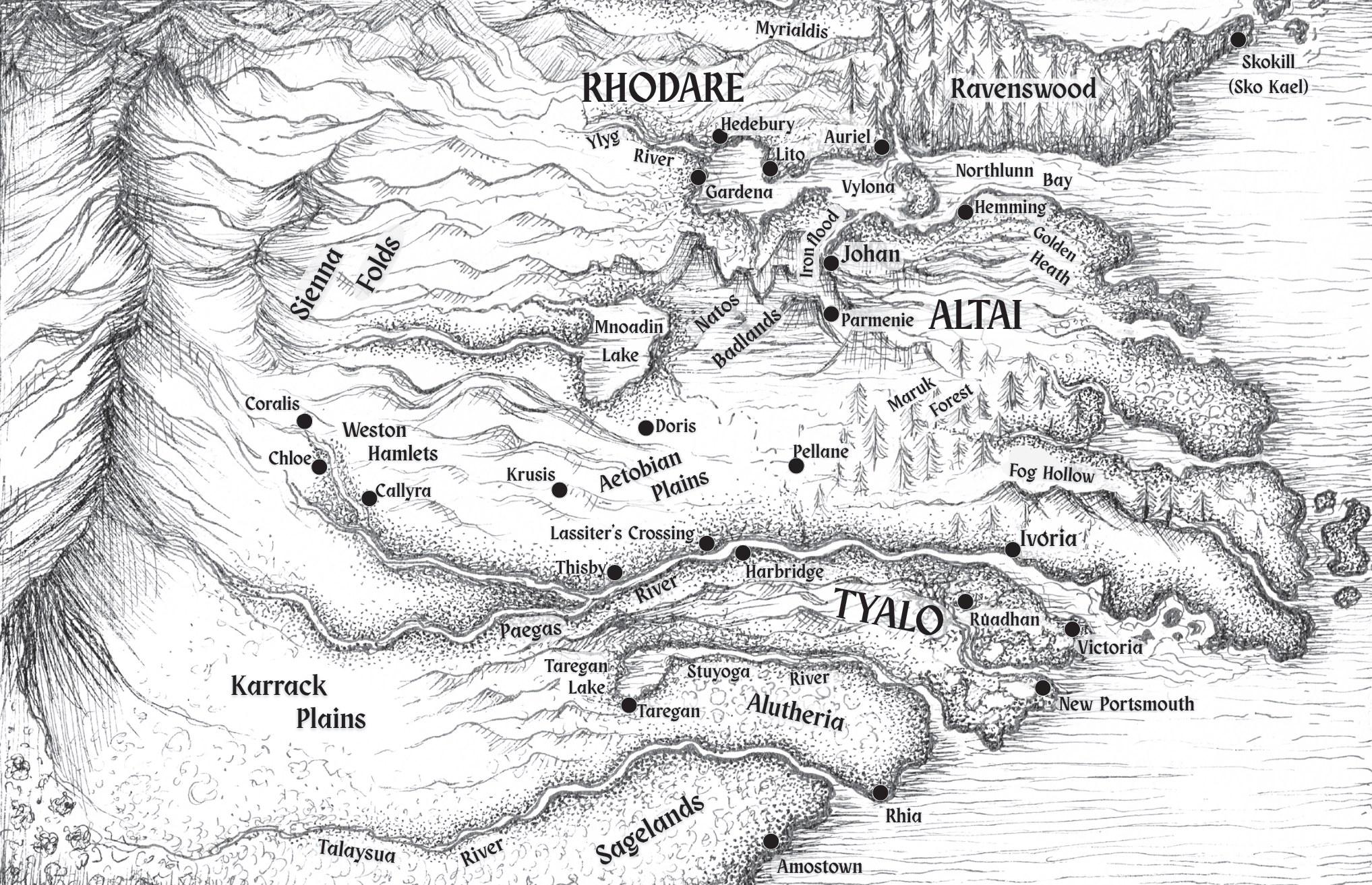
Kim Peterson's black-and-white map of the western continent of Second Rain

The western continent.

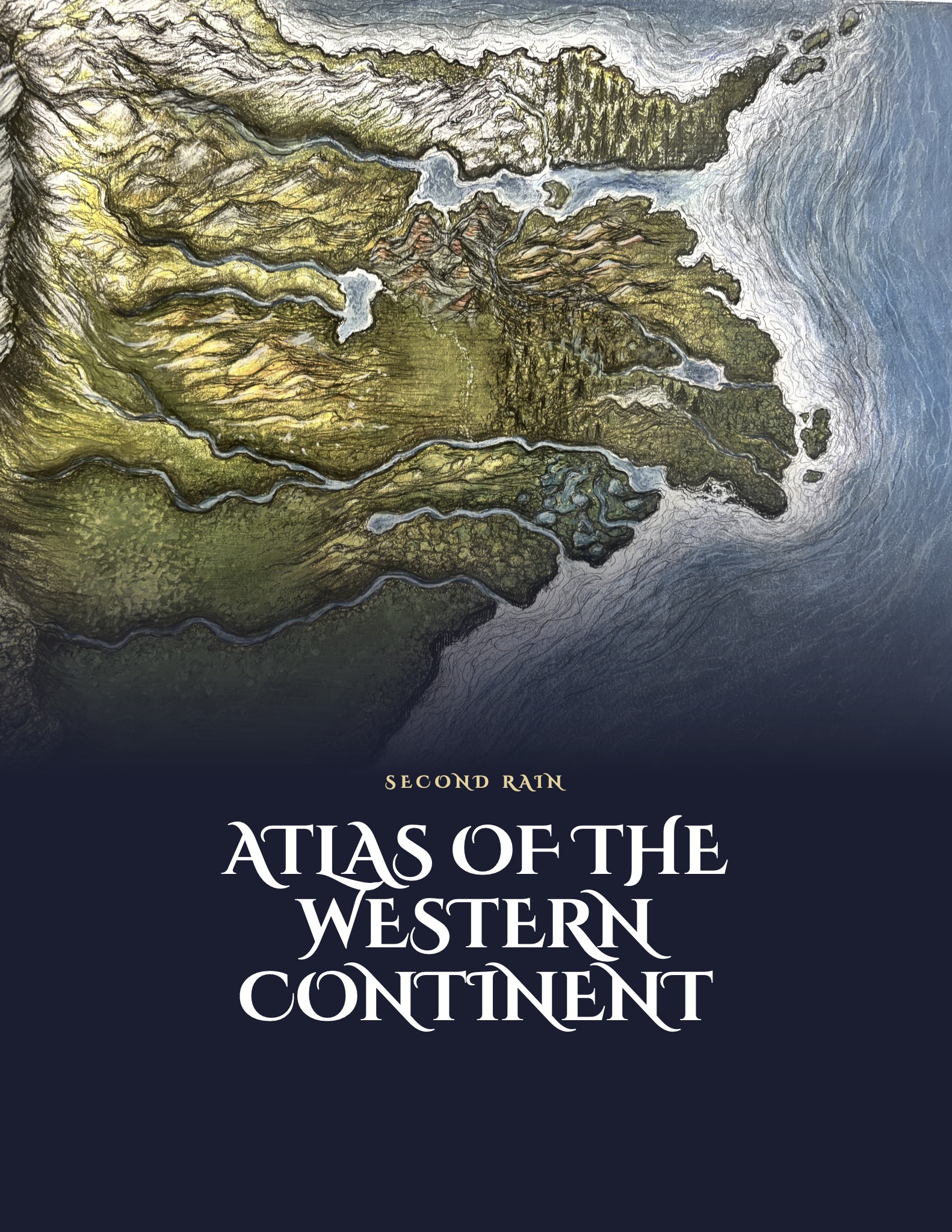
Cover of the Atlas of the Western Continent, with Kim Peterson's painted map

The full atlas

Dive deeper into this world

The Atlas of the Western Continent is the full history behind these maps: how the three states were founded, the witch hunts of Rhodare and the Last Magus, the Dead State of Altai, the clans of the Vermillion Bayous, the Clan War, and the frontier of the south and west.

Free with Margin Notes: early excerpts and news on upcoming books.
We will never share your information with third parties.

Explore the regions

Up close

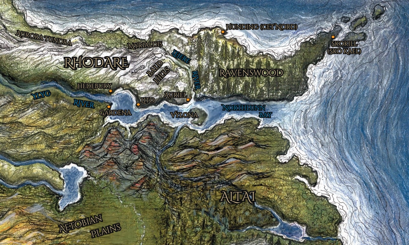
Kim Peterson's color map of Rhodare, Ravenswood, the Ylyg River and the Isle of Vylona.

Region 1 of 4

Rhodare

Around 1005, settlers arrived to form what would become the first western state. They came to escape monarchs and emperors who could agree upon only two things: enmity with each other and encumbering the peasantry in order to sustain palaces.

To be an earl or countess in Rhodare is to be honored, not duty-bound.

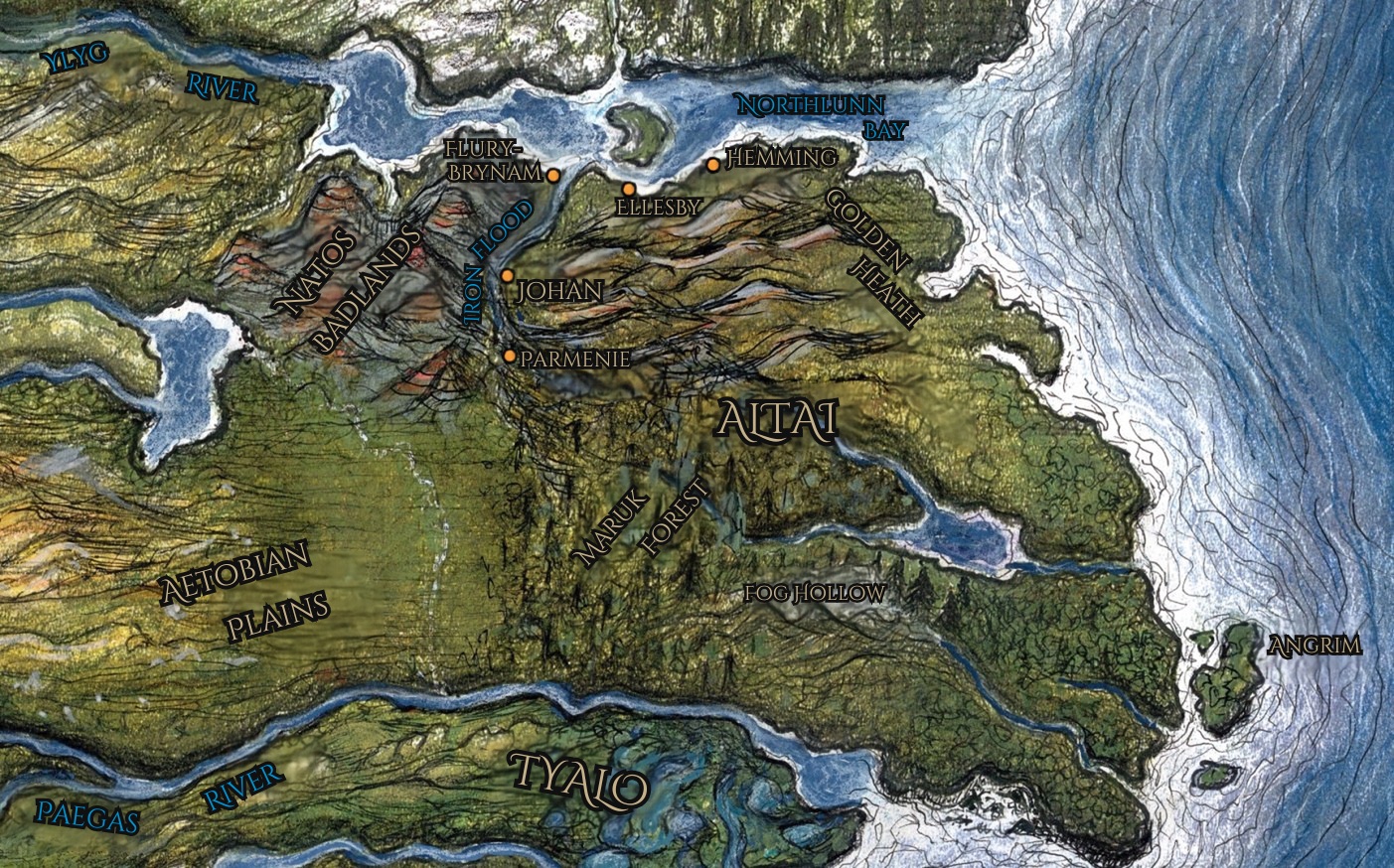
Kim Peterson's color map of Altai, Johan, the Maruk Forest and the island of Angrim.

Region 2 of 4

Altai

Settlements emerged along the Ironflood three to four generations after Rhodare formed. First was Johan, which remains Altai’s capital.

Due to brigand raids and piracy, the entire eastern half of Altai became a joyless scrubland. Residents clung to the Ironflood and adopted Rhodarian customs, and so Altai is today known as the Dead State.

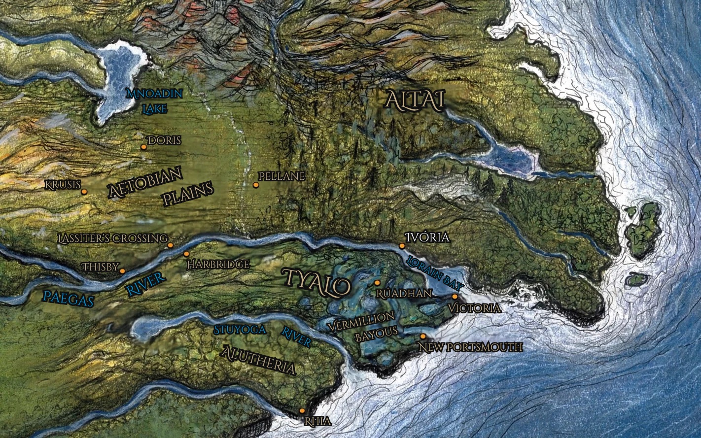
Kim Peterson's color map of Tyalo, Ivória, the Vermillion Bayous and the Aetobian Plains.

Region 3 of 4

Tyalo and the Plains

In merely eight generations, Tyalo has become the most populous state by far. What began as a harbor, guardhouse, and barracks has developed into Ivória, the largest port on the continent.

The power of the Plains lies within the independence of its townships, where mayors govern locally, citizens voice concerns in the town halls, and volunteer militias keep the general peace.

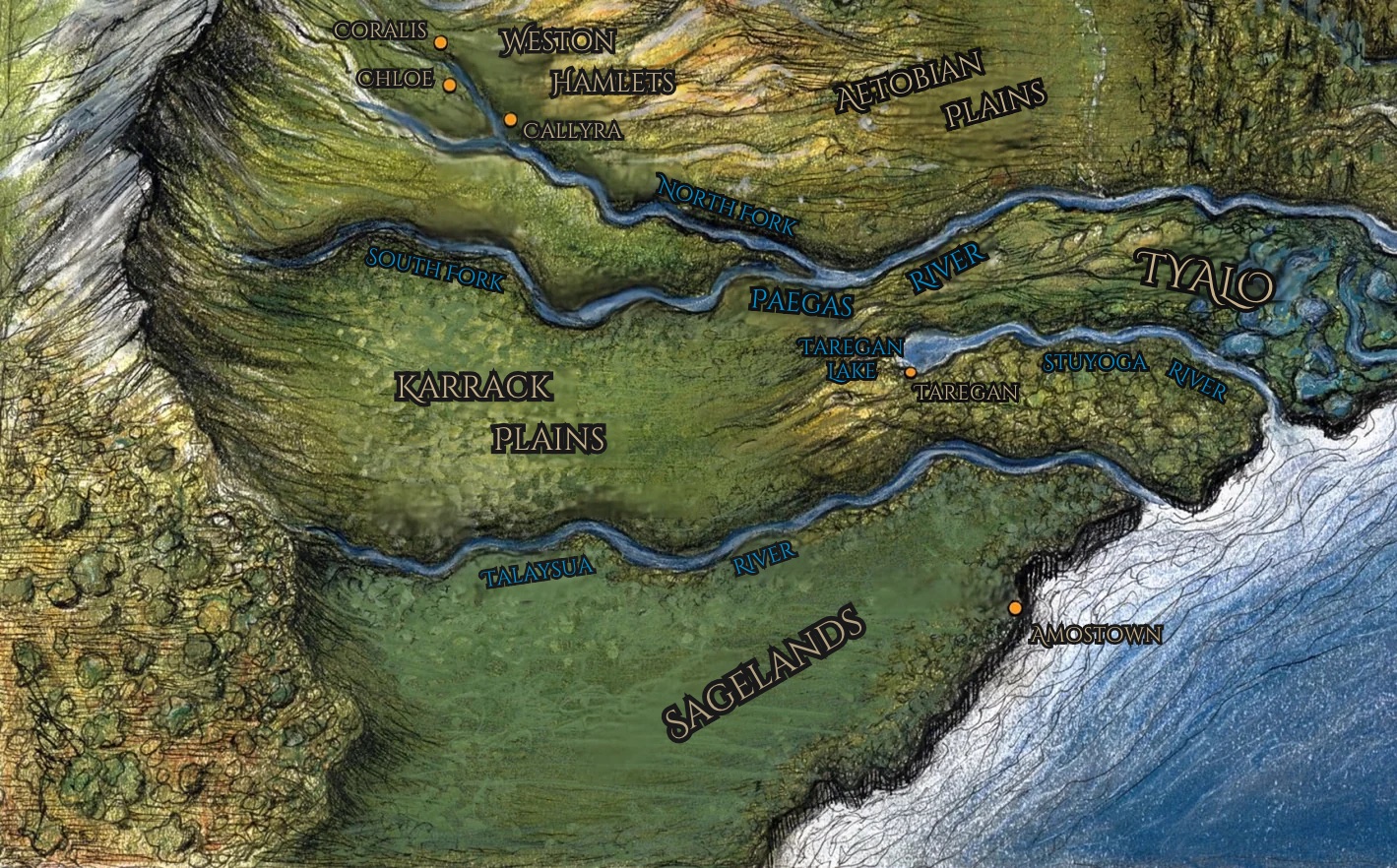
Kim Peterson's color map of the Karrack Plains, the Weston Hamlets and the Sagelands.

Region 4 of 4

The South and West

The frontier is inhabited by clans and settlers of unaligned hamlets. Though it would be harsh to label them “uncivilized,” they certainly lack the luxuries and comfort of the states.

With nascent settlements forming along the forks of Paegas River, we could easily see a new western state form within a century.